
Industry-Sponsored Student Capstone Projects
2022/2023
In the 2022/23 academic year the industry capstone program was supported by 56 sponsors and 99 real-world projects. Nearly five hundred and fifty students from across the College of Engineering participated. Scroll down to learn more about each project.
Cyberworks Robotics
Autonomous Self-Driving Wheelchair
Autonomous Wheelchairs increase freedom and ease of mobility for the most vulnerable peoples in society. Large-scale, campus-wide, autonomous navigation of a power wheelchair faces numerous corner case confounds ranging from loss of localization due to feature-sparsity to human motion sickness. This student team worked to identify and address corner cases that allow for robust persistent navigation over vast indoor and outdoor regions within the UW campus and fleet integration to the cloud for remote monitoring, user authentication, and over-the-air updates. Low hardware cost is essential to mass adoption of such technology. Therefore this student team also worked to focus on use of inexpensive but cutting-edge technologies, such as monocular Neural SLAM and Dense Optical FlowML Behavior Cloning, as a means to reduce or eliminate reliance on expensive LiDAR based visual SLAM. Ultimately, this student team worked to create graceful, robust, autonomous wheelchair navigation in large-scale real-world environments at an affordable price using the Cyberworks Autonomous Navigation Stack.
Echodyne
Radar-Cued Camera Data Collection System
The rapid increase in the availability and sophistication of UAS (Unmanned Aircraft Systems) represents a significant challenge, as their capabilities progress faster than the ability to assess and mitigate the threat posed by nefarious small UAS. Counter Unmanned Aircraft Systems (C-UAS) is a collection of technologies to detect, track and mitigate UAS systems. Echodyne's radar technology is a leader in the active RF detection and tracking of UAS and, when combined with an EO/IR camera for visual target confirmation, provides a very effective system solution. Independently classifying a UAS target with these two modalities and fusing the result would yield improved classification precision and accuracy. Cueing pan/tilt/zoom cameras based on a 3D radar track is a fairly established technology. Using an Echodyne radar with tracked target classification output and applying advanced machine learning techniques, this student teamworked to leverage an available camera cueing solution and demonstrate both camera-based target classification and the fused combination with radar data. The outcomes this student team worked toward include: - Develop a proof of concept system that takes radar tracks, cues an EO/IR camera and provides real-time UAS image classification and serves as a reference design for future product developments - Develop ML/AI training models and inference algorithms for UAS image classification - Demonstrate the benefit of multi-modal (radar + optical/IR) sensor UAS classification with precision/accuracy metrics - Document how to extend the training dataset and retrain any models, possibly extending to other detection classes (pedestrians, vehicles, planes, etc.) - Document implemented system, lessons learned and recommended next steps
Empowered Startups
Using Unmanned Aerial Systems (Drones) to Predict, Detect, and/or Manage Climate Events
This student team attempted to create a unmanned aerial vehicle (drone) prototype that governments and agencies can use to feed data into a remote software. This drone could have sensors that will detect conditions in the environment (i.e. wind, speed, moisture or temperature) and shares that data to assist in efforts to predict, identify and/or manage climate disasters and to deliver help and supplies to survivors (i.e. deliver medical supplies to survivors in remote locations, trigger water supply changes, or emergency relief). An example of such a technology that exists is the Internet-of-Things (Iot) being used to help predict forest fires. Relevance: The climate emergency has intensified with extreme weather events becoming more frequent and powerful. In 2022 alone, the U.S. experienced extreme tornadoes and heat, in Southern Europe extreme droughts caused water bodies to dry up, and Pakistan experienced the worst flooding in the nation's history brought on by a massive monsoon that blanketed a third of the country under water triggering a massive crisis.
Envorso / Ford Motor Company
Making Electric Vehicle Charging Fun (with the Ford F-150 Lightning)
This student team worked to create an ideal Electric Vehicle charging experience that addresses the hurdles faced by EV owners today when trying to use public charging networks. Approaching the activities of budgeting power, finding a charger, and completing charging while on-the-go will include this student team to working to creative design and scenario formation. Specific pain points this student team worked to address included: - Billing , charge status, alerts of progress and problems, conveying charging rates in a way that makes sense to the average non-technical consumer, etc. - Can charger health become easy to understand in real-time? - Hardware, Software, and User Experience improvements (hardware improvements may be modeled, may require simulated data; if actual charging units are required for student ideas, additional investigation and scope is required). Outcomes this student team worked to accomplish included: - An end-to-end prototype of the "charging experience of tomorrow," factoring the full-stack of the charging experience from infrastructure (grid and distribution) to the vehicle/charger experience, completion of the process through billing. - Full software prototypes that can be experienced in vehicle. - Proposals in the form of click-through presentations for infrastructure. A stretch goal the student team aimed to work towards include: - Models or walkthroughs (3D or VR) would be fantastic for experiencing the facilities around charge points.
Fluke
Anomaly Detection for Solar PV Inspection Using IR Thermography
Unmanned Aerial Vehicle (UAV) inspection systems are becoming an efficient method for operating and maintaining various types of infrastructure. One of the use cases for UAV systems is to detect anomalies in photovoltaic power plants. UAV systems can be equipped with infrared and visual cameras and take images from photovoltaic panels. An image processing algorithm is used to detect and classify the type of anomaly. This student team worked to create a UAV system that can detect anomalies on photovoltaic panels using infrared and visual light cameras. All the computations was to be done using the Nvidia Jetson Nano Developer Kit mounted on the UAV system.

GE Vernova
Battery Scheduling for Carbon Reduction
This student team worked to research load + solar + storage systems and the ways to best schedule energy storage for minimum greenhouse gas emissions. Using historical grid carbon intensity data from https://www.watttime.org/ or other sources, students attempted to first determine net carbon emissions for a typical residential or commercial load over the course of a month. Next, students worked to assess the impact of installing a PV system, assuming a system size and output profile using historical weather data and information and a basic PV production model. Finally, the students worked to design a battery energy storage system and controller that couples with the solar installation to minimize the net carbon footprint. The student team attempted to design the battery controller (rule-based, PID, LP, etc.) to steer battery charging/discharging during day-to-day operations towards a least carbon objective, taking into account load, grid carbon intensity data and solar output.
Intel
Platform Architecture Optimization Using Insights from Analysis of User and Processor Data
This student team worked to study the trend of web-based apps and its impact on client resource utilization based on DCA classification of web-usage categories. This included detailed Analysis of web-based Computing Trends: In-browser, Progressive Web Apps (PWA), and Electron-based. As web technologies evolve and computations migrate more freely between the cloud & client, this student team worked to study: - Growth over time of web categories (DCA already has the browser usage data) - Client resource utilization and change over time - Client system execution characteristics over time (e.g., context switch rate) - Computational demands over time - Are apps becoming more or less demanding of the client? - What aspects of computations are changing most?
Jamestown S’Klallam Tribe, Environmental Planning Program
Jamestown S’Klallam Tribe Community Resiliency Center
The Olympic Peninsula has limited electrical transmission capacity, limited on-peninsula repair crews, and disaster-vulnerable landscapes and populations, resulting in poor electrical reliability and susceptibility to long duration power outages. This student team worked to explore the cost and capabilities of a renewable energy generation & storage microgrid to make the Jamestown S’Klallam tribe's tribal community center a resiliency hub that keeps critical communications infrastructure live while supporting other community needs during long duration power outages. This student team worked to build off of prior analysis staff at the Washington Clean Energy Testbeds have performed to support the microgrid Seattle City Light recently completed at the Miller Community Center and Snohomish County PUD recently built in Arlington. Microgrids for community resiliency are a growing area for engineering design. An advisory group helped guide the technical and community elements of all three microgrid projects on the Olympic Peninsula. Desired outcomes this student team worked towards include a final engineering report that: (1) Describes the context for the study, including a statement of the community resiliency goals and metrics based on community input, and the data sources available for estimating the electrical loads in the community center, solar and wind energy potential of the site, and other environmental factors (site hazards, fuel availability, etc.) (2) Applies community priorities and engineering principles to determine microgrid infrastructure needs and costs to support the highest priority loads under several discrete operational scenarios, for example, outages occurring in summer vs winter, and for islanded operation of days, weeks, or months (following a catastrophic disaster). (3) Detailed technoeconomic analysis of a base case design, including engineering drawings, site analysis, component lists and estimated pricing, with performance informed by real time digital simulation of the renewable grid operated over a typical one year period at the site. A stretch goal for this project that the student team could work toward is exploring alternative cases, such as considering the role of bidirectional charging of mobile resiliency units the Tribe has funding to purchase.
Jefferson County Department of Emergency Management
Microgrids for Community Resiliency on the Olympic Peninsula
Poor electricity reliability and slow restoration of power is an everyday issue for residents of the Olympic Peninsula, but FEMA suggests that the civilian response time for a significant regional event (e.g., major Cascadia fault earthquake) will be from 3 months to one year, with an expectation that the population be prepared for self-sufficiency during that period. The Jefferson County Department of Emergency Management is concerned about their reliance on fossil fuel back-up generators to support the department, sheriff, and 911 centers, and worked with a student team to explore the cost and capabilities of a renewable energy generation & storage microgrid for long duration power outages. This student team worked to build off of prior analysis staff at the Washington Clean Energy Testbeds have performed to support the microgrid Seattle City Light recently completed at the Miller Community Center and Snohomish County PUD recently built in Arlington. Microgrids are a growing area for engineering design. An advisory group helped guide the technical and community elements of all three microgrid projects on the Olympic Peninsula. Desired outcomes this student team worked towards including a final engineering report that: (1) Describes the context for the study, including a statement of the resiliency goals and metrics based on DEM staff input, and the data sources available for estimating the electrical loads, solar and wind energy potential of the site, and other environmental factors (site hazards, fuel availability, etc.) (2) Applies DEM priorities and engineering principles to determine microgrid infrastructure needs and costs to support the highest priority loads under several discrete operational scenarios, for example, outages occurring in summer vs winter, and for islanded operation of days, weeks, or months (following a catastrophic disaster). (3) Detailed technoeconomic analysis of the base case design, including engineering drawing, component lists and pricing estimates, with performance of the design evaluated using real-time digital simulation.

Korry Electronics
Ruggedized Haptic Feedback Touchscreens for Aerospace Applications
Touchscreens in aerospace cockpits have been established for many years, following the consumer trend experience of smart phones and tablets. However, an adoption barrier for both usability and safety considerations has been the "in turbulence, at night, during an emergency" scenario. Aerospace grade touchscreens currently provide no tactile feedback and also require visual attention on the surface. Industry and academic research has explored various approaches to haptics via various transducers. Korry believes these technologies can be integrated into existing display and bezel designs to provide presence detection before touch, and force feedback both of position within screen and confirmation of touch intent. This student team worked to research and select a tactile feedback method that works to meet these goals, taking into consideration the aerospace application requirements, and then work to integrate that into an existing display module demonstrator. The student team then attempted to run the demonstrator integrating the feedback mechanism through a series of human factors evaluations to attempt to confirm usability, reliability, and reduction in pilot workload. Desired outcomes this student team worked towards included better understandings of the benefits and limitations of the current state of the art and the ability to demonstrate to Korry's customers future capabilities in this area that improve aircraft systems safety, usability, and user experience. Anticipated deliverables this student team worked towards included a brief trade study of haptics technologies and design trades, along with the decision criteria for the selected approach. Any selected implementation produced would then be prototyped and integrated with an existing Korry touchscreen display. Finally, the student team worked to confirm the effectiveness of the prototyped technology and identify areas for future research through human factors evaluations.

Lockheed Martin
JetRacer Soccer League
This project was a second year continuity of the JetRacer Soccer League project. This student team worked to utilize artificial intelligence to train RC vehicles to play competitive soccer. In the previous year, hardware was developed along with preliminary development of image recognition and object following. For this year, this student team worked to focus on improving the soccer playing capabilities of the vehicle through machine learning including striking a ball into a goal from a variety of positions on the field and showing logic capabilities for edge cases. A part of this also included the student team working to develop a simulation environment for the JetRacer to train. After demonstrating a 1 vs. 0 soccer scenario, the student team then worked to add a second agent to play 1 vs. 1 soccer. Ultimately, this work attempted to provide insights in to the use of machine learning in a competitive environment while giving the students industry exposure to project management and development. The outcomes that this student team worked to accomplish included: (1) An updated open source guide uploaded to GitHub that explains how to recreate the artificially intelligent vehicles capable of playing soccer and contains build instructions for the soccer arena plus any support equipment, (2) Development of machine learning structure to train the vehicles, (3) Up to four JetRacer vehicles with operational sensors and software, (4) Simulation and experimental data acquired throughout the project, (5) A documented summary of the results of the work and objectives achieved.
NanoString
Deep Learning-Based Localization for RNA Spatial Transcriptomics
Nanostring spatial molecular imaging platform (SMI) leverages single molecule hybridization-based sequencing chemistry to spatially profile expression of 1000+ genes at single cell and sub cellular resolution across tissue samples. The current RNA localization algorithm relies on commonly used methodologies where potential target locations are segmented from raw images and fit with a function that approximates a point spread function. While efficient and fast, this method will fail in the multi-emitter regime. Due to the desire to increase plexity and/or use reduced codesets, it is critical to evaluate other localization schemes that are designed for densely packed data. DECODE is a state-of-the-art deep learning-based approach that enables high precision localization microscopy in dense images. This student team worked to deliver modified DECODE modules that are tailored towards high density SMI samples. The student team also worked to develop models with adequate consideration towards compensating raw data that has highly variable background and large signal dynamic ranges and outperforms standard localization methods in SMI data by an order of magnitude with respect to density, defined as having a Jaccard index >~70%. The student team also worked to provide a Python module to enable 3D clustering of localizations to find the best fit Z-plane to allow for code matching via Nanostring’s matching module.

NASA Jet Propulsion Laboratory
Machine Learning for Extreme Traverse Lunar Explorer
This student team worked to apply machine learning algorithms to Lidar data and images taken during the operation of a subterranean robot in extreme environments on Earth and the Moon. The robot utilizes autonomy to operate an extreme traverse architecture (snake-like robot). The near-term application is sub-glacial environments on Earth, and real-world field data of experiments with the snake-like (EELS) robots can be provided. A desired outcome this student team worked towards was the demonstration of a machine learning algorithm to autonomously identify and potentially characterize hazards in Lidar image data taken from the field experiments of the EELS robot. These experiments would be performed in ice crevasse and other glacial-like environments. As a stretch goal, the student team could work to integrate other perception sensor data on the exterior/skin (i.e. torque sensing, temperature data) of the EELS snake robot into the ML algorithms based on Lidar imaging.
NASA Jet Propulsion Laboratory
Machine Learning for Lunar Multi-Static Ground Penetrating Radar
The project sought to apply machine learning algorithms to multi-static radar images taken from a network of autonomously cooperating robots. The student team worked to develop such algorithms to be used on real-world data obtained from the multi-static GPRs operating on NASA’s CADRE Technology Demonstration on the moon, schedule for launch 2024. GPR data is essential for in-situ resource utilization discovery and characterization, and sub-surface science more generally. These resources include water ice, materials that can be used in propellant or power generation. A network of GPRs can generate significant data volumes in short periods of time that must conventionally be analyzed by “humans-in-the-loop” approaches, these can take from hours to days or more. In addition data oberved under the surface may be useful in guiding or controlling the mobile GPR platforms (robots) to new physical locations, this may occur in very short time-scales (seconds to minutes). Combining these factors along with the limited communications bandwidth from the moon (or other planetary body) to Earth, provides strong motivation to autonomously and intelligently analyze and characterize the raw multi-static GPR data to arrive at useful information. Machine learning algorithms offer significant potential in this regard. A desired outcome was the demonstration of a machine learning algorithm to autonomously identify and potentially characterize significant identifiers or discriminators in model data, real-world data from controlled field experiments, and finally real-world data obtained from the surface of the moon.
NASA Jet Propulsion Laboratory
Machine Learning for Smart Space-Based Radiation and X-Ray Spectrometer Instruments
This student team worked to apply machine learning algorithms to the space-based operation and calibration of two small instruments that are planned to fly on a CubeSat mission in the 2024 timeframe. The instruments generate time-series data streams at the output based on physical properties measured at their respective inputs. The challenge this student team worked to address is to convert these time series data streams into useful information that is: 1) reliably reproduceable and related to actual physical properties being measured, and 2) to calibrate the information such that error is either known or bounds can be placed on the information. The student team was able to work to utilize the dynamic environment, both the physical parameters being measured and the environment the sensor operates in (e.g., space environmental factor such as temperature) as models to more accurately use the raw data to infer actual physical property being measured. Machine Learning is a technique that has been used successfully in these type of application in the past, and this student team was encouraged to explore the use for these two sensors. A desired outcome this student team worked to accomplish was to demonstrate machine learning algorithms to autonomously calibrate time-series outputs from two instrument, radiation sensor and x-ray spectrometer, based on the space environment the sensors will operate in. In other words, software that will convert raw data streams from the instruments into useful calibrated information.
Related News
Mon, 10/13/2025 | UW Mechanical Engineering
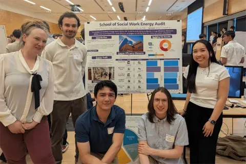
Capstone collaboration leads to award
An ME capstone team received first place for its energy audit of the UW School of Social Work building.
Mon, 07/07/2025 | UW Mechanical Engineering
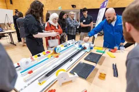
Capstone creations
Students displayed innovative capstone design projects at the 2025 expo.
Fri, 09/20/2024 | UW Civil & Environmental Engineering
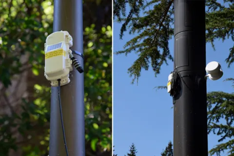
Smarter irrigation for a greener UW
A new project combines satellite data with ground sensors to conserve water and create a more sustainable campus environment.
Mon, 09/09/2024 | UW Mechanical Engineering
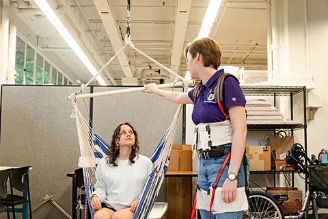
Testing an in-home mobility system
Through innovative capstone projects, engineering students worked with community members on an adaptable mobility system.